Secret Places? A chance to see a spot that no one else stops at? Not on this list! But if you are planning your first trip down through the Deso / Gray Canyons, this list includes places that I wouldn’t want to miss. They are all well known and well traveled…
- Turtle Rock
- Flat Canyon Petroglyphs
- Rock Creek Ranch
- Three Canyon ridge top
- Three Canyon rincon
- Range Creek – Golden Stairs, Creek, Loop
- School Section Canyon and cliff
- Rattlesnake Loop
Bonus: the secret campsite below 3 Fords.
76.4 Turtle Rock. From either of the camps, go back from the beach and then follow the trail downstream. It will wind along for a ways and look for a large tree out in the open. The trail turns to the right and goes uphill. Look for a large rock, about 4′ high. Look for the turtle shell fossil on the top surface of the rock.
63.2 Flat Canyon Petroglyphs. Well worth the stop. Look for a very well-worn 12′ high bare bank found on a long section of vegetated shoreline. A short walk back to the panel.
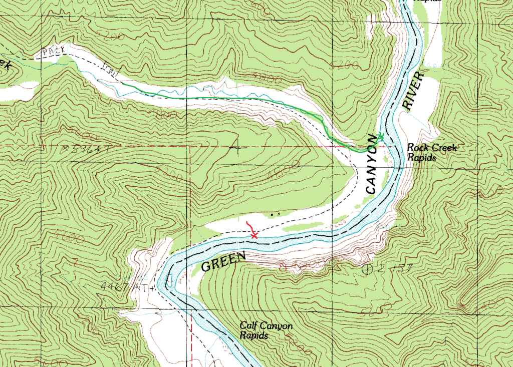
53.0 Rock Creek Ranch – Red: the pull-out to hike over to the ranch is near the lower end of the long straight section. There is an open beach and you can see the ranch buildings through the trees (I think…)
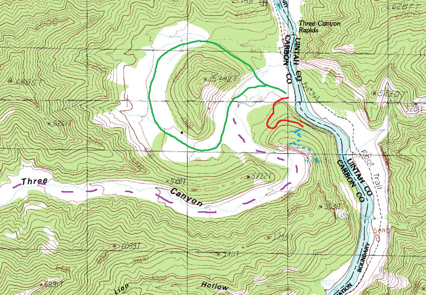
49.8 Three Canyon. Several nice camps. Red: an established trail that takes you to the top of the cliff that overlooks the river. The trail continues on downstream, but is not as well used past the cliff. Blue: continue on your own up to the ridgeline. One of my favorite spots! Green: a pleasant hike around the rincon. Purple: Hike up the canyon for a longer, layover day hike.
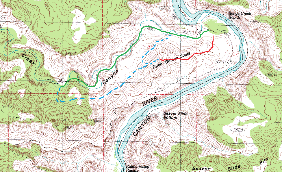
31.0 Range Creek. Nice camp, very popular – expect company. Overflow camps along the beach below the main camps. Red: Three Golden Stairs – a well-established trail. Easy hiking, although significant scrambling at the top. Green: Hike up the creek. Depending on creek level, maybe wet feet. Blue: Climb out of the creek valley and return on the open slope. Find your own way out – not sure which bend we climbed out at. Also possible to loop down from the top of the Golden Stairs.
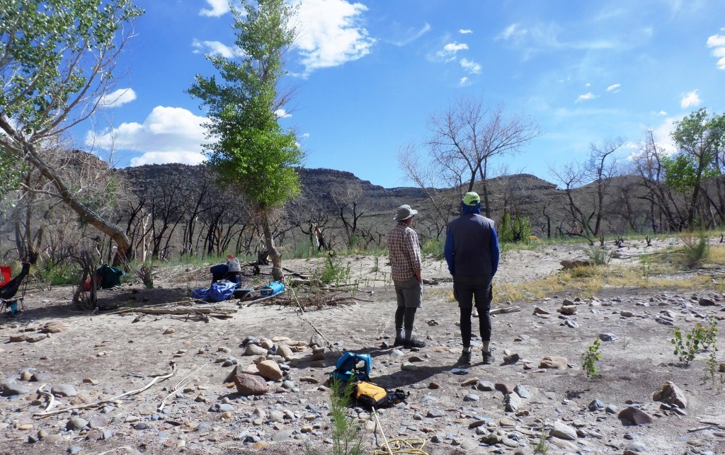
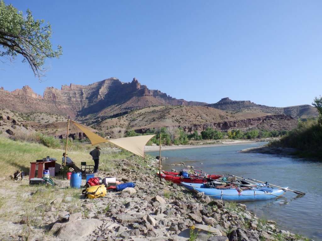
Note: Historically, Range Creek was a beautiful, sheltered camp with shade and large cottonwoods. There was a fire in late 2024 and it’s not the place that it used to be. There is plenty of space to camp, but the shade and shelter are limited. We still plan to camp there for both hiking and to watch what happens as successional growth comes back. The picture below shows it on our April, 2025 trip.
22.3 School Section. A nice (but quirky) camp. Kitchen on the beach, tents in a nice opening up the trail. Green: Up a beautiful, narrow canyon. Easy hiking at first, some scrambling part way up. Some shade. Blue: The cliff shown in the guidebook, plus a nice view looking downstream. It’s fairly small beach. My take on it is that if you camp here in the early afternoon, you should expect (and welcome) people who are just stopping to go on a hike.
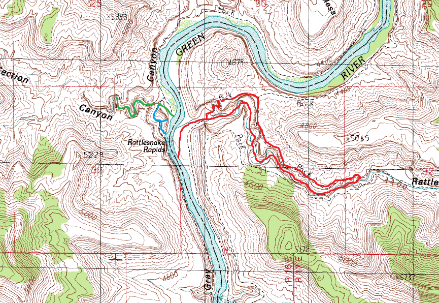
22.0 Red: Rattlesnake Loop. Hike up the canyon, climb out onto the plateau (pick your spot – the line on the map is approximate. The place we climb out is pretty low-key. Maybe 50′ easy scramble?). Back on the plateau and down an established trail to river level. Top of the trail is marked with cairns and is easy to find. Either leg makes a nice out and back hike. Rattlesnake is a popular camp, but there are overflow camps below it along the left bank.
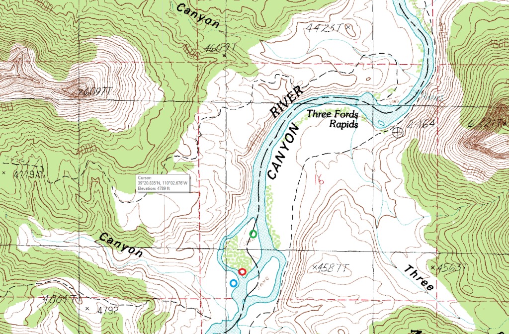
35.5 Bonus: ‘Secret’ campsite. Lots of people camp above and below Wire Fence Rapid (at a couple of very nice campsites). They then get up and run Three Fords rapid as the first thing in the morning. We’ve occasionally run Three Fords at the end of the day and then dropped down to the island a mile below. The beach at the red circle is relatively exposed (and may be under water at high flows), but you could retreat into the woods up the bluff (although they are old trees and be wary of falling branches in a storm.) You can access the beach from the middle river channel if the flow is too low to go down river right. I’ve never camped at the green circle, but I’d consider it for shelter in a major upstream wind (you’d have to walk a bit). You might also be able to find something downstream near the blue.
Back to the main Green River page