We have always taken out at Flag Point. Over the years, the number of bridges that are in good repair has varied, as well as the consequences of missing the right-most channel. Currently, the bridge at 31 mile is washed out, leaving two possible takeouts.
We have always taken the rightmost channel, just below Childs Glacier and stayed to the right, ending up at Flag Point. Historically, that has worked well. On our last trip, July, 2026 @ 143,000 cfs, it was ‘not the best’.
NOTE: The following comments are my current thoughts and are posted as a possible aid for trip planning. I have only actually floated the yellow path and you should evaluate current conditions and make your own decisions! 🙂
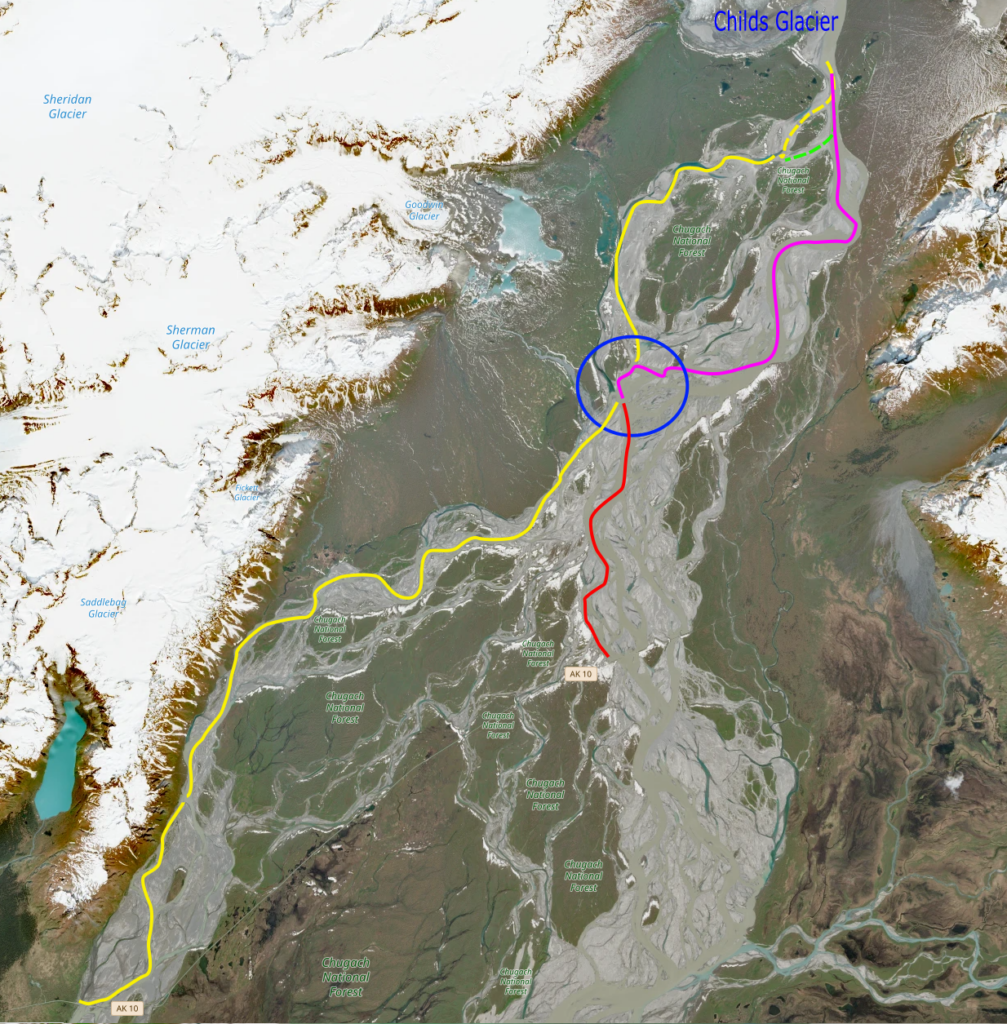
Key to the map:
- Yellow line: Our route, July, 2026 @ 143,000 cfs
- Dashed yellow line: very low water. We had to drag the raft once.
- Dashed green line: a bit more water than the first yellow channel. Once the two channels merged, there was adequate (but low) flow down to the blue circle.
- Pink line: route that I anticipate taking next time. (and then going right and taking the yellow line to Flag Point)
- Yellow line below blue circle: plenty of flow and a nice route. I like going down the line of mountains on the right bank and coming to their end at Flag Point. Makes a fitting end to a great trip. We stayed to river right at the end through some shallows; it looked like you could stay in the main channel and cross to the right at the last minute. (possible takeouts are available on the other banks, but might require carrying your equipment further.)
- Red line: what appears to be the main channel down to Hotcake Channel and a good takeout. We have never floated this, but we drove out to look at the takeout after this trip. See discussion and pictures below.
- Blue circle: What appears to be the crux of the routes. When we came out at the bottom of the top yellow line, we were in a large channel and it looked like we could go either way.
Copernicus Browser – source for the satellite imagery shown below. I’d check it for a recent image before going…
Hotcake Channel Takeout: We drove 9 miles from Flag Point to the washed out bridge at Mile 31. There was a very large channel up against river right, an obvious view of the stub end of the bridge. Take out upstream of the bridge (near the boat in the picture). There is a solid, flat bar that you could drive out to the river bank. The only ‘issue’ is the drop down to the bar (see picture). I think I could take my van down and back up, but did not actual do it.
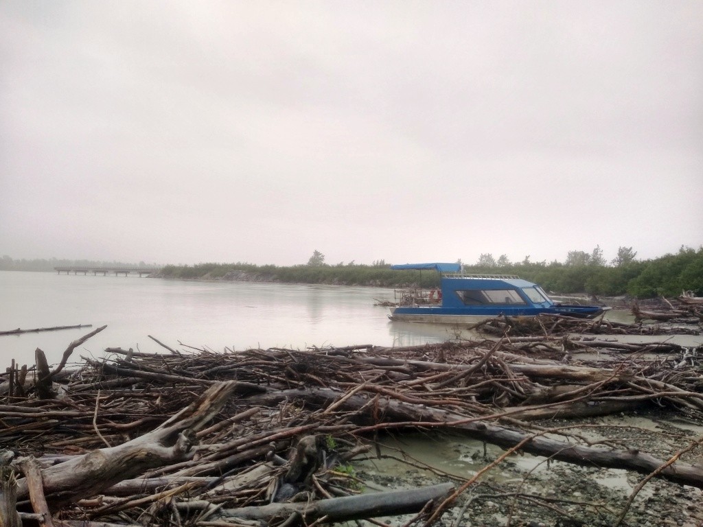
Hotcake takeout, looking downstream. Land on the beach near the blue boat. Note the stub of the washed out bridge in the background. Do NOT go under the stub bridge to take out below!
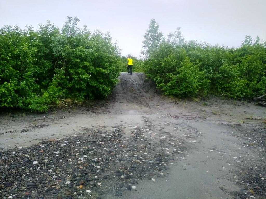
The notch to drive from the road down to the beach. It would be a long carry if you were not ready to drive down (and back up) this notch. There was plenty of room to ‘make a run for it’ to drive back up.
Return to Trip Report page